UPDATED: Jan. 29, 2010 – List of child development centers affected by the Haiti earthquake
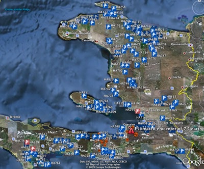
Here is a Google Earth image showing the approximate location for the earthquake’s epicenter in relation to our child development centers.
The image is just intended to give perspective not definitively identify where all the centers are located. However, there is a discussion thread in Facebook about the location of some centers.
The fact that many development centers are so close to one another means that some centers can’t be seen. And obviously the size of the image makes it difficult to read the numbers that are visible. We published a larger image in Twitpic and in Facebook.
The blue icons represent child development centers, and the red icons represent child survival programs. Most red icons hide behind the blue ones, but for some reason a few show through.
The orange circles represent earthquake activity in the last week (or so).

Here is an additional Google Earth image that highlights a 750 square mile section of Haiti relative to the earthquake so you can more clearly see which child development centers are closest to the epicenter.
We published a larger image in Twitpic and in Facebook.


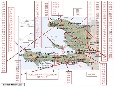
This graphic is a year old but it is still valuable in helping identify the proximity of a child development center to Port-au-Prince.

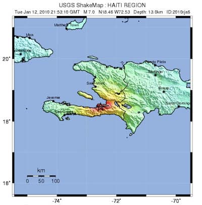
This is a US Geological Survey shakemap for the Haiti earthquake that helps illustrate the strength of the earthquake and the breadth of its reach.

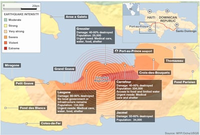
This is a BBC map that helps provide a picture of how badly areas outside of Port-au-Prince were hit.